Patrick Mullins
- pmulllns2FREEwashcoll
- Cromwell 217
Office Hours
Tuesdays 3:00-4:00 PM and Wednesdays 4:00-5:00 PM, or by appointment (Zoom or in-person).
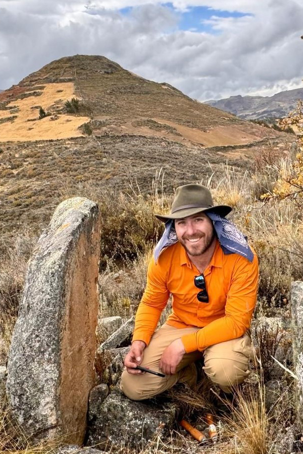
Dr. Mullins' WebsiteMy name is Patrick Mullins and my work weaves together archaeological data, archival research, and geospatial analyses to bring ancient human histories and landscapes to life for audiences in both academia and the broader public. I have directed projects and written scholarship in a variety of subjects and settings: from reconstructing and analyzing ancient settlement patterns to doing disaster relief and community development work.
Education
- Ph.D., Anthropology, University of Pittsburgh, 2022
- M.A., Anthropology, University of Pittsburgh, 2015
- B.A., Archaeology & Ancient/Medieval History, University of North Carolina at Chapel Hill, 2012
Academic Expertise
- Archaeology
- Aerial Drone Mapping and GIS
- Ancient/Prehistoric South America
- Borderlands
Having worked as an archaeologist in Peru for the past 15 years, I teach a variety of courses that integrate my wide knowledge and datasets on prehistory of South America and the many complex societies that emerged in what is now modern Peru. In my courses we investigate everything from the solar alignments encoded in some of the earliest pyramids built in the region to the ancient fortresses that guarded the frontiers of the warring Chimu and Inka Empires. I have also taken Washington College students to Peru during the summers to help with my fieldwork projects mapping ancient temples and fortresses using aerial drone platforms.
Additional Information
- Visiting Fellow, Sainsbury Research Unit, University of East Anglia, 2023
- Adjunct Instructor, Department of Anthropology and Sociology, The College of New Jersey,2023
- Junior Fellow in Pre-Columbian Studies, Dumbarton Oaks Research Library and Collections, 2018-19
- 2023, From Households to Empires: Papers in Memory of Bradley J. Parker. Sidestone Press. Eds. Jason Kennedy and Patrick Mullins.
- 2023, Borderlands of the Moche Valley: The Chimú Phase (~900 – 1450s CE) Chaupiyunga and the Rise of Chimor. In, From Households to Empires: Papers in Memory of Bradley J. Parker. Sidestone Press. Eds. Jason Kennedy and Patrick Mullins.
- 2023, Into the Borderlands. In, From Households to Empires: Papers in Memory of Bradley J. Parker. Sidestone Press. Eds. Jason Kennedy and Patrick Mullins.
- 2019, Imperios y Fronteras en La Chaupiyunga: La Frontera Chimú-Serrano del Periodo Intermedio Tardió y Horizonte Tardío en el Valle Moche. In, Actas de La Primera Mesa Redonda de Trujillo: Nuevas Perspectivas en la arqueología de los valles de Virú, Moche, y Chicama. Eds. Gabriel Prieto and Alicia Boswell, pp. 302-315. Fondo Editorial Universitario Universidad Nacional de Trujillo, Perú
- 2016, Webs of Defense: Structure and Meaning of Defensive Visibility Networks in Prehispanic Peru. Journal of Archaeological Science: Reports. 8:346-355.
- 2024, Collaborative Summer Research Grant, Hodson Trust for Undergraduate Research, Washington College
- 2023, Visiting Fellowship, Sainsbury Research Unit, University of East Anglia
- 2023, Curtiss T. and Mary G. Brennan Foundation Grant
- 2018-19, Junior Fellow in Pre-Columbian Studies, Dumbarton Oaks Research Library and Collections
- 2017, National Science Foundation Doctoral Dissertation Improvement Grant, Award #1719283
- Introduction to Environmental Archaeology
- Culture, Power, and the Human Experience: Anthropological Inquiry
- South American Archaeology
- Fantastic Archaeology
- Borderland Studies
- Human Evolution and Bioanthropology
- Archaeology of Warfare
- Remote Sensing, Spatial Analyses, and 3D Modeling
- Introduction to Cultural Anthropology
The Proyecto Arqueológico Historia y Prehistoria de los Guacapongos y Llampas (PAGuaL) is a recent research initiative that I have begun in collaboration with Dr. Amedeo Sghinolfi (Université du Québec à Trois-Rivières), Dr. Dana Bardolph (Northern Illinois University), and Lic. Elvis Monzon (Universidad Nacional de Trujillo) to explore the deep pasts of borderlands, imperialism, and conflict in the Carabamba Plateau of the northern Peruvian highlands. We are particularly interested in understanding the political landscape of this region during the florescence of the Kingdom of Chimor (900 – 1500s CE), a period that saw the rise of several large, fortified towns on the Carabamba Plateau. Were these towns the centers of highland kingdoms that were hostile to Kingdom of Chimor? Did they perhaps play a part in the epic struggles between the Kings of Chimor and the Inka Empire? With generous support from the Brennan Foundation and Washington College, our pilot fieldwork in Summer 2024 targeted several of these fortified towns for an aerial drone mapping program that has helped us begin to answer some of these questions.
In addition to PAGuaL, my long-term work on the Moche Valley Settlement Database (MVSD) is my largest ongoing research project. The MVSD is a composite of Prehistoric (~10,000 BCE – 1500s CE) and Viceroyalty Era (1500s – 1800s CE) settlement pattern data that includes site locations, site descriptions, aerial drone maps, early historical maps and census data, and local Indigenous stories and histories of landscape features and places. Over the past decade, I have compiled most of these data into a GIS database covering around 1700 km2 of the Moche Valley and its adjacent highlands. The completed MVSD will provide a uniquely wide spatial and temporal lens through which varied scholars can investigate settlement patterns associated with a host of phenomena and moments in time: the seasonal rounds of earliest settlers of the valley, the rise and fall of local polities like the Moche or Chimor, and the introduction and exploitation of African slaves amongst the early haciendas of the rural landscapes around Spanish Trujillo.