Watershed Innovation Lab
Our Mission is to make the Chester River the best understood river in the world and to use this data in schools to teach students about the environment.
The Watershed Innovation Lab is a hub for advancing state-of-the-art practices in watershed management. Based at Washington College’s Center for Environment and Society, the Lab works to ensure a future where Eastern Shore communities have access to — and value — clean water resources, healthy coastal ecosystems, and the science needed to protect them.
We conduct high-impact, interdisciplinary research at the intersection of water, land, and people. Through field monitoring, remote sensing, watershed restoration research, and community partnerships, we generate practical knowledge that supports better decisions for rivers, streams, wetlands, shorelines, and the Chesapeake Bay.
The Watershed Innovation Lab also creates meaningful experiential learning opportunities for Washington College students. Students work alongside faculty, staff, and partners on real-world water science projects, gaining hands-on experience with monitoring equipment, geospatial tools, field methods, data analysis, and restoration planning.
Through education and outreach, we help grow a community of water resource leaders. We connect students, educators, landowners, practitioners, and decision makers to explore water resource challenges and develop science-based strategies for protecting and restoring Eastern Shore watersheds.
What We Do
Water Quality Monitoring
The Watershed Innovation Lab monitors water quantity and water quality across the Chester River Watershed to better understand how the river, groundwater, climate, land use, and the Chesapeake Bay interact. Our monitoring work supports research, restoration planning, education, and long-term understanding of environmental change on the Eastern Shore.
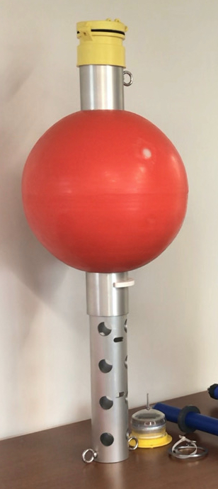
- Water Quality Sensors: We deploy and maintain water quality sensors on docks, buoys, and other monitoring platforms throughout the
Chester River and its tributaries. These sensors collect continuous data that help
us track changing conditions such as temperature, salinity, dissolved oxygen, turbidity,
and other indicators of river health.
- Weather Stations: We build, install, and maintain weather stations that improve local climate and weather monitoring. These stations help us better understand precipitation, temperature, wind, and other conditions that influence runoff, flooding, water quality, and ecosystem health.
- Groundwater Wells: We install and maintain shallow groundwater wells to study how groundwater and surface water interact in the watershed. This work helps us understand water availability, contaminant movement, saltwater intrusion, and the connections between land management and aquatic ecosystems.
Together, these monitoring efforts contribute to the Chester River Watershed Observatory, a growing network of data, tools, and field sites that supports research, student learning, partner projects, and public access to watershed information.
WIL Water Quality Data
How to Use HydroVu Data
Remote Sensing
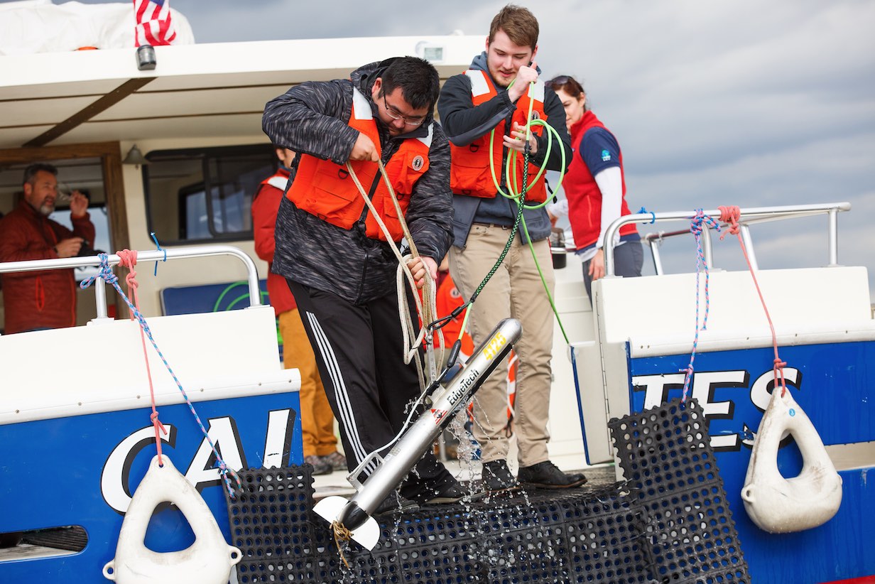
The Watershed Innovation Lab uses advanced remote sensing technologies to map and study underwater environments in the Chester River, Eastern Bay, and surrounding Chesapeake Bay waters.
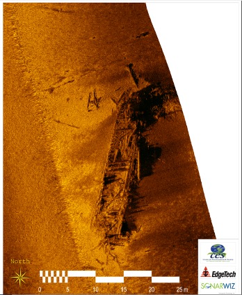
Using the 27-foot Research Vessel Lookdown, we collect high-resolution underwater data with side-scan sonar, bathymetric mapping systems, and sub-bottom profiling equipment. These tools allow us to map river and bay bottoms, identify habitat features, examine sediment and geologic structures, and support restoration planning.
Our remote sensing work helps identify and characterize habitats that are important for oysters, submerged aquatic vegetation, fisheries, and other aquatic resources. Washington College students gain hands-on experience with field surveys, sonar systems, geospatial analysis, and the interpretation of underwater landscapes.
Sometimes we even find sunken ships!
Watershed Restoration Research
The Watershed Innovation Lab conducts applied research that supports watershed restoration and management across the Eastern Shore. Our work connects field data, geospatial analysis, stakeholder knowledge, and restoration planning to help identify where conservation and restoration actions can have the greatest impact.
A major focus of this work is the Langford Watershed Alliance, a partnership working to improve water quality, restore habitat, and strengthen community engagement in the Langford Creek Watershed. Through this effort, the Lab supports monitoring, site assessment, mapping, planning, and research related to living shorelines, wetlands, forest buffers, stream restoration, oyster habitat, submerged aquatic vegetation, and other nature-based solutions.
By combining science, local knowledge, and partner expertise, we help advance restoration strategies that are practical, place-based, and responsive to community and ecosystem needs.
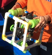
Experiential Learning for Washington College Students
The Watershed Innovation Lab provides Washington College undergraduates with hands-on opportunities to participate in meaningful water science work. Students contribute to internships, field monitoring, laboratory analysis, geospatial mapping, remote sensing surveys, restoration planning, and science communication.
Through these experiences, students develop technical skills while working on projects that directly support watershed research and management. The Lab also supports classroom and field-based learning, including lectures, labs, boat-based experiences, Chesapeake Semester activities, and collaborative projects with faculty and staff across campus.
Our goal is to prepare the next generation of scientists, managers, educators, and community leaders to address complex water resource challenges.
STEM Education
The Watershed Innovation Lab works with educators, students, and community partners to expand access to watershed science and environmental education. We develop curriculum, field activities, lending kits, teacher workshops, and outreach programs that connect learners to local water resource issues.
Our STEM education work emphasizes hands-on, place-based learning. Students and teachers explore topics such as water quality, climate change, sea level rise, submerged aquatic vegetation, watershed modeling, monitoring technology, and restoration practices.
By partnering with schools, nonprofit organizations, agencies, and regional collaborators, the Lab helps build environmental literacy and supports a broader community of people who understand, value, and care for Eastern Shore watersheds.
K-12 Classroom Kits
See all available class kits here.
Build-A-Buoy
We challenge all age groups to build a buoy that will break the “world's record” for the number of golf balls it can hold or how high it can stand without tipping over. Small buoys are built with PVC pieces that hold over 50 golf balls or stand a meter high without falling over. An indoor/outdoor thermometer is attached to create an observation buoy that measures water and air temperature. Build-A-Buoy kits that service 30 students at a time are available for educators to rent.
Optional text
Sea Level Rise
This Earth science activity uses the online NOAA Coastal Flood Exposure Mapper and Sea Level Rise Viewer tools to model how coastal locations will be affected by local sea level rise in comparison with current flooding risks. Students will go through a brief tutorial of how the modeling websites work before exploring them on their own.
Optional text
Nautical Charts
Morbi leo risus, porta ac consectetur ac, vestibulum at eros. Donec ullamcorper nulla non metus auctor fringilla. Integer posuere erat a ante venenatis dapibus posuere velit aliquet.
Optional text
Submerged Aquatic Vegetation
This Earth science and biodiversity activity uses publicly available data from one U.S. federal source, one Maryland state source, and one public university source to examine and map how temporal changes in the Chesapeake Bay and/or its rivers impact vital benthic habitats within the Bay and its watershed, as well as the different ways these environmental conditions are measured and recorded.